Our mountain bike guide, Julien Paganelli, tells us to put on extra layers before stepping off the cable car. "There it's ten degrees," he says, pointing down the valley. "Up here, it's zero."
It's early September, and the weather is flitting between drizzle and fine snow.
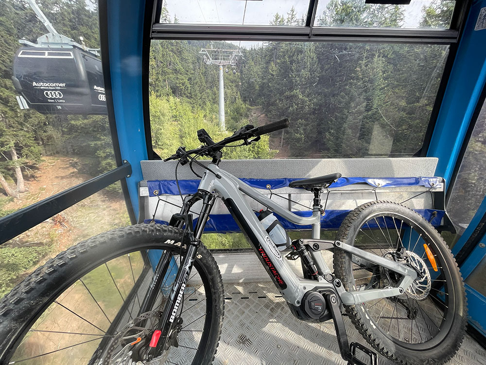
To get the bikes into the cable car, we had to remove the front wheels. At the top, fixing the wheels back on, Julien looks around at the cloud and ice and says, "Welcome to the moon." I swing my arms like a helicopter to get feeling back into my fingers.
At 3,000 metres, we are shrouded in cloud. We pedal to the glacier’s summit plateau, where a shard of light breaks through and hits the glacier. It’s both terrifying and incredible at the same time. I tentatively begin the descent, feet off the pedals, skirting the shale in case I need to stop suddenly. A few metres down, the cloud breaks fully, the light bleaching the landscape flat — black rock, white ice, nothing in between. When I stop to watch the others pick their way down, they're just silhouettes against the sky.
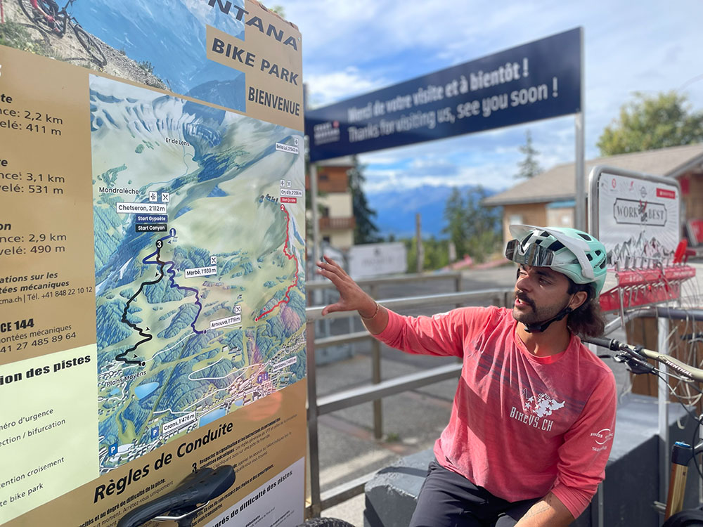
Julien is the founder of BikeVS. Born in Sierre in the valley, he has been riding since he was twelve and guiding for years. Swiss-qualified, he helped build many of the trails he guides on. He knows which lines are on the official map and which ones require his knowledge. "If you're here for a long time, you can find your way yourself," he says. "On an e-bike, it's easier. On a pedal bike, one wrong turn can cost you hours."
Finally on the Map
The full route links glacier to vineyard, 35 kilometres, roughly 2,500 metres of vertical drop, and is on the official map for the first time from summer 2026. We're not riding all of it. The weather is predicted to close in, and one of the bikes has a mechanical issue, so we take the official AlpRide line; high alpine terrain waymarked and opened to riders for the first time, running from the glacier edge down through the Col des Gendarmes, the Ertenze Valley and the Col du Pochet.
It's the newest addition to a network that's been growing over the years, with 22 itineraries, 139km, and more trails being certified each season. Whether you ride the full descent depends on conditions, your confidence, and how much pushing you're willing to do.
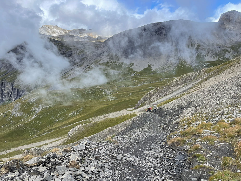
The first section is full of rocky ‘shark fins’ jutting out from the trail. I ride it in bursts. Sometimes I'm on foot pushing the bike, sometimes seated and dragging my feet along the ground.
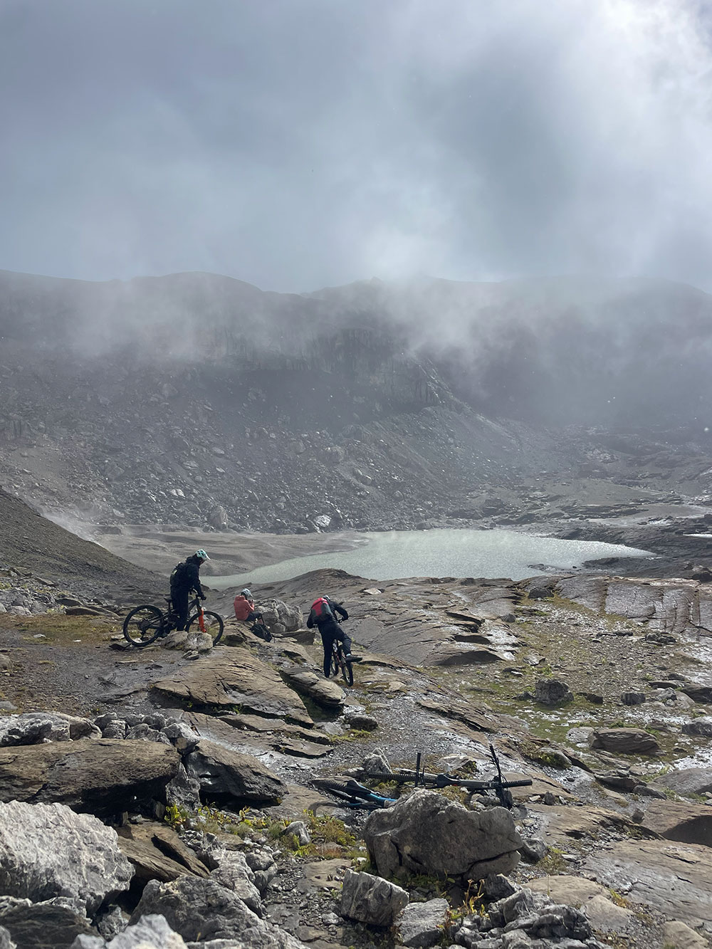
By the time we reach Lac de la Plaine Morte, the cloud has thinned to torn swabs of silk above a slick plateau where you can ride almost anywhere if you can read the red-and-white alpine waymarkers. Julien explains the options: the dam route, the Col du Pochet, trails that drop all the way to Sion or Saint-Léonard, including, on a better day, Lac d'Eton lower down. We opt to take the official line down towards Violettes.
To get there, Julien stops us dead at a narrow section. To our right, the cliff drops away into nothing, a shale track barely wide enough for the bike, the rock face rising on one side, nothing on the other. "Keep the bikes to the right," he says. "So if they fall, the bike goes, not you." We tentatively push ours along. Julien cycles it, obviously.
Then the push. The map shows it as a gentle contour line. In practice, it's seventy metres of loose rock, straight up, in the full sun. Someone ahead of me gives up pushing and hoists their bike onto their shoulder instead. I consider it. My Rocky Mountain bike, although light and playful, weighs about half what I do. I keep pushing. I'd have killed for yesterday's e-bike.
Julien points out the full route, including a ladder section further on where he sometimes carries clients' bikes while they climb. That's not on today's agenda either.
The gradient eases
Lower down, the gradient eases, and the landscape opens out, with wide green slopes and a singletrack threading away below us. We stop. Julien produces apple compote and a "Twickers", a local bakery's answer to the Twix and Snickers simultaneously. It's exactly what's needed.
More people appear, hikers and bikers, along with educational signs outlining the five rules of trail use. Hikers have priority. Some routes close when wet, and dogs are banned on certain sections. "It's about cohabitation," Julien says.
The trail gets technical again further down. It’s ungroomed, more of a walker's path than a bike trail. There’s no exposure here, but the grass is rutted, and the bike wants to follow the channels rather than my line. I get off a lot.
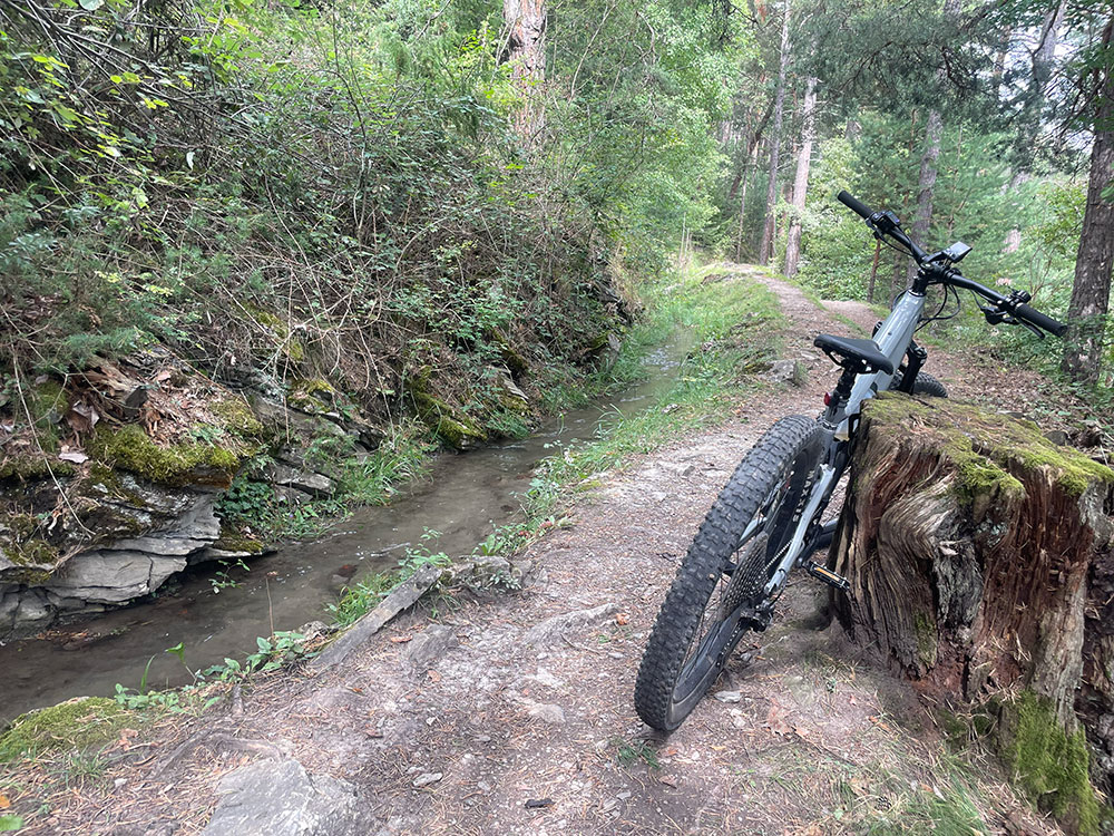
Lower down into the trees, the trail narrows around a waterfall, with water sheeting down the rock face beside us, and the path slick and loose underneath. It's still technical, but after the glacier, the forest feels almost gentle.
By late morning, we're back at the Colorado Rider's Chalet in Barzettes — a small lodge 300 metres from the Violettes lift station, run by Olivier and his family, with a bike workshop in the basement and rooms themed around the sports that bring people here. The ride ends more or less where it began.
Not everything in Crans-Montana demands that level of commitment. The day before, we'd explored the resort's lower trails on e-bikes; a different world from the glacier entirely, but the same mountain.
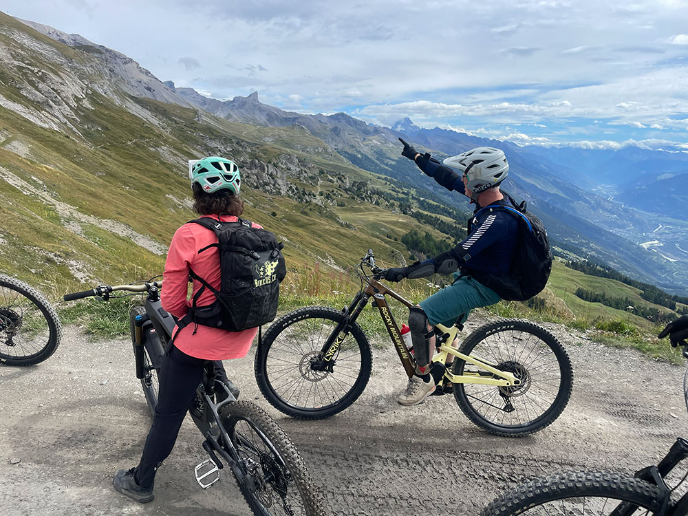
We took the gondola up to Cry d'Er at 2,256 metres. The lift station sits next to a bar called Zero Dix, which feels like exactly the right place to end a day rather than start one.
From up here, the plateau opens out, and the mountains fall away on all sides. To the left, what Julien calls the Imperial Crown with five summits of over 4,000 metres. On a clear day, you can pick out the Dent Blanche and the peaks above Arolla, then further right the Matterhorn, which is today buried in cloud. To the right, Mont Blanc floats beyond the three sharp peaks that frame the valley. Italy and France are both visible on a good day. Below are forests, golf courses, and the valley, glowing green and gold with vineyards.
The protected wildlife area of Vallon de Réchy sits below. It’s wolves and lynx territory. Julien once spotted them while trail running. "I shat my pants," he says cheerfully.
We start with the brand new flow trail that’s been open for barely a month. It drops towards Montana village, open and fast, with one near-vertical ten-metre pitch that appears without warning, then dissolves into a series of linked berms so well-shaped you barely need to think. We can take the free bus back up if we need to.
Then the red trail, with 531 metres of descent in around three kilometres. Julien thinks it's the best on the mountain. I'm inclined to agree.
Below, we stop at the Olympic cross-country course, which sits right by the resort centre, with tight turns, rock gardens, and timber features. The course hosted a UCI Mountain Bike World Cup round in 2024, when Tom Pidcock, the British road-and-mountain-bike crossover, won both XC races just days before starting the Tour de France. A year later, it hosted the World Championships themselves.
Julien explains how the race lines work. There are three options through the technical sections. The slowest, what he calls the chicken line, is there if you need it.
"Last year, most didn't take the A-line until the last laps, then they did," he says. We peer down at what looks to me like a treacherous drop, with plenty of options for catching a tyre on a thick ridge of rock.
Enter like a cat, leave like a tiger
Nearby is the Timber Garden, fifty metres of stacked logs that riders scale mid-race. Last year it was raining. This year, the logs are dry, which Julien says makes it faster and considerably more terrifying.
I ask him about cornering. How do you handle the speed on a banked turn? He thinks for a second. "Enter like a cat," he says. "Leave like a tiger." Brake going in, climb the highest point of the berm, then release. I'm still working on it.
There are also family loops, mellow firetrack rides, and routes designed to work almost year-round. Free buses link lifts, villages and trailheads, and you can wash your bike in town with a handful of coins.
"Everywhere you look, there are bike trails," Julien says. He prefers singletrack to jeep roads, remote to busy. "You don't decide in the evening, oh, tomorrow I'll do that. It's something you have to plan. Look at the map. See the options."
We stop in town at a bakery. I have the quiche du mois and a boozy berry macaron. Tomorrow will be rocky, rough and ungroomed, today felt like the easy day.
We stop for lunch at the Lac des Miriouges, then drop down through Lens — old houses, some on stilts, names of the families who built them carved above the doors.
From Lens, we make a technical climb to the Christ Roi, a 30-metre copper statue built in 1935, visible from every district in Valais. The statue has three fingers raised, which Julien tells us stands for the three original Swiss cantons. Locals compare it to Rio de Janeiro. Our bikes lean against the steps at its base while we catch our breath. From up here, you can see back to Cry d'Er, where the day started, and the hill we came through on the way, called Goat Mountain.
We follow a bisse down from the hill. In the fourteenth century, cliff faces were blasted to create these waterways to bring water down for livestock. It was so dangerous to build that people died making them. The bisses are now so iconic in Switzerland that they appear on the hundred franc note. The Rhône valley spreads out far below. We come down through Diogne, where Julien stops to pick fresh prunes from a tree at the side of the path.
We soon roll into the vines and stop at a vineyard belonging to a friend of Julien's, where each vine is carefully pruned to one or two bunches, top-end Valais production. We taste pinot noir grapes straight off the plant, sweet and warm.
Sierre sits below us in the sun. Julien says it gets more sunshine than Algiers, and around Martigny, he adds, cactuses actually grow.
We cycle through Sierre past Château de Villa, where vines grow right up to the walls, before dropping down to Lac de Géronde for a beer. We dump our bikes on the grass near a buvette by the lake, where a pink flamingo pedalo bobs on the water. After a day on the mountain, it feels slightly surreal. Then someone remembers the funicular timetable. I pour the rest of my cider into my water bottle and jump back on the bike.
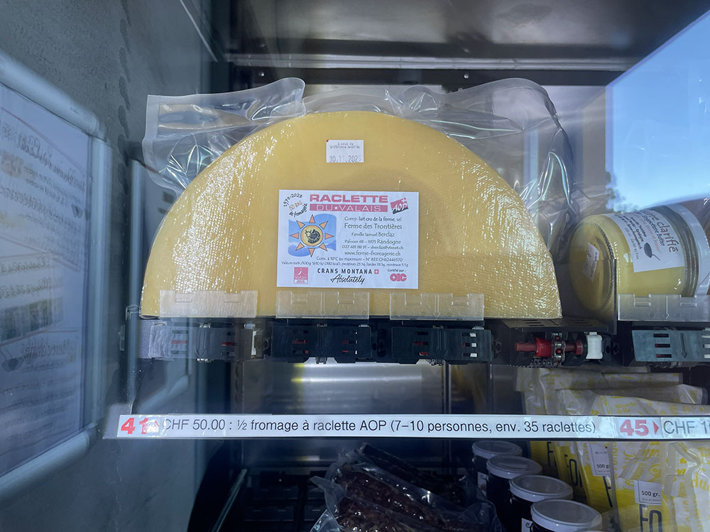
Twenty-four hours later, the glacier is done. That evening, the ride ends not with stats or Strava screenshots but with raclette; cheese from a vending machine at a nearby farm, which is completely normal here, especially when friends drop round unexpectedly. The same machine also sells potatoes and pickles. We melt it ourselves back at the Chalet, in the communal room Olivier keeps for exactly this kind of evening.
After two days that between them covered glacier, forest, bisse, vineyard and lake, my shoulders hurt more than my legs. It feels like exactly the right way to finish.